
Fire Support Bases
![]()
![]()
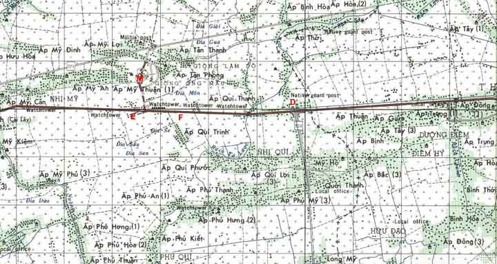
The map on left is courtesy of Mike Milton (DISCOM) and shows some of the FSB locations along QL4.
The map on the right is used as reference. Look for Rt. 211, running N/S as a reference on both maps.
The following is commentary from Paul Kasper.
Point "M" is the location of FSB
Moore, a place that I am sure that you may have visited, if you were in-country from April 68 until the 9th ID left SVN. Point "E" is a little compound that we called "Camp Mohawk", that was manned by Echo 2/39 Recon in April - June 1968. Point "F" is the approx. location of FSB Fels, the first FSB manned by the 2/39 Btn along Hwy 4, from Feb - April 1968. Point "D" is the location of Ft Dent and the intersection on Hwy 4 where a track was blown up.If you have information about the location and time of existence of other FSBs, e-mail the web-master with the info and it will be posted.
![]()